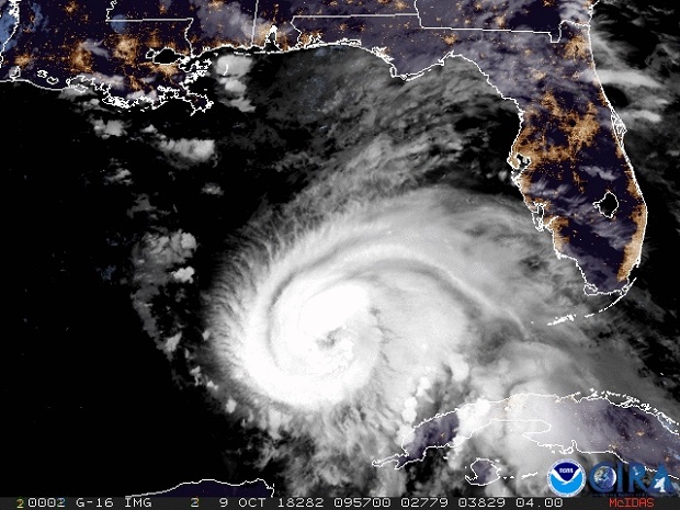
According to the Washington Post, Florida’s northern Gulf Coast faces its most serious hurricane threat in more than a decade as Michael edges ever closer. The intensifying storm is likely to make landfall Wednesday as a Category 3 hurricane, and conditions will begin to deteriorate Tuesday night.
The hurricane peak winds reached 110 mph as of 11 a.m. Tuesday, just 1 mph shy of Category 3, according to the National Hurricane Center.
Florida’s Panhandle, from Pensacola to Apalachicola, and its Big Bend area are the zones of greatest concern. Michael is poised to push ashore a “life-threatening” surge of ocean water that will inundate those coastal areas. The storm also will unleash flooding rain and destructive winds starting Tuesday night and continuing through Wednesday.
“There are warnings for more than 300 miles of coastline,” the National Weather Service tweeted, predicting that Michael will become a “large and dangerous hurricane.”
Some of the population centers that could witness some of the most severe hurricane effects include Fort Walton Beach, Destin, Panama City Beach and Apalachicola.
The surge, or the rise in ocean water above normally dry land along the coast, could reach at least eight to 12 feet in the hardest-hit areas, inundating roads, homes and businesses. Mandatory evacuations have been ordered in several Florida counties.
“The window of time to prepare is closing,” tweeted Florida Gov. Rick Scott Tuesday morning. “This is a serious and life-threatening situation- don’t take any chances. If you have been told to evacuate, leave.”
Destructive winds sustained near 125 mph along with higher gusts near the hurricane’s core could affect some locations near where the storm makes landfall.
“Everyone in the hurricane warning area along the Florida Gulf Coast should prepare for life-threatening major hurricane winds associated with the core of Michael,” the Hurricane Center said.
Click here for full article on the https://www.washingtonpost.com/

